

Main Facts
Long before it became a bustling urban sector synonymous with major international trade shows, business conventions, and city transit, the land beneath modern-day Quinta Paredes and Corferias in Bogotá was a tranquil, sprawling countryside estate. In the mid-to-late 19th century, when Bogotá was little more than a chilly, high-altitude provincial village defined by cobbled alleys, dim oil lamps, and heavy adobe structures, the western plains were a patchwork of verdant pastures, dairy farms, and meandering creeks.
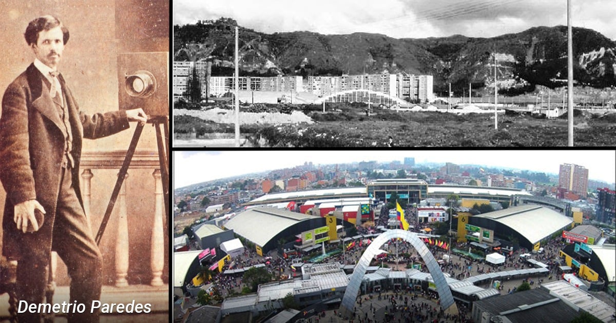
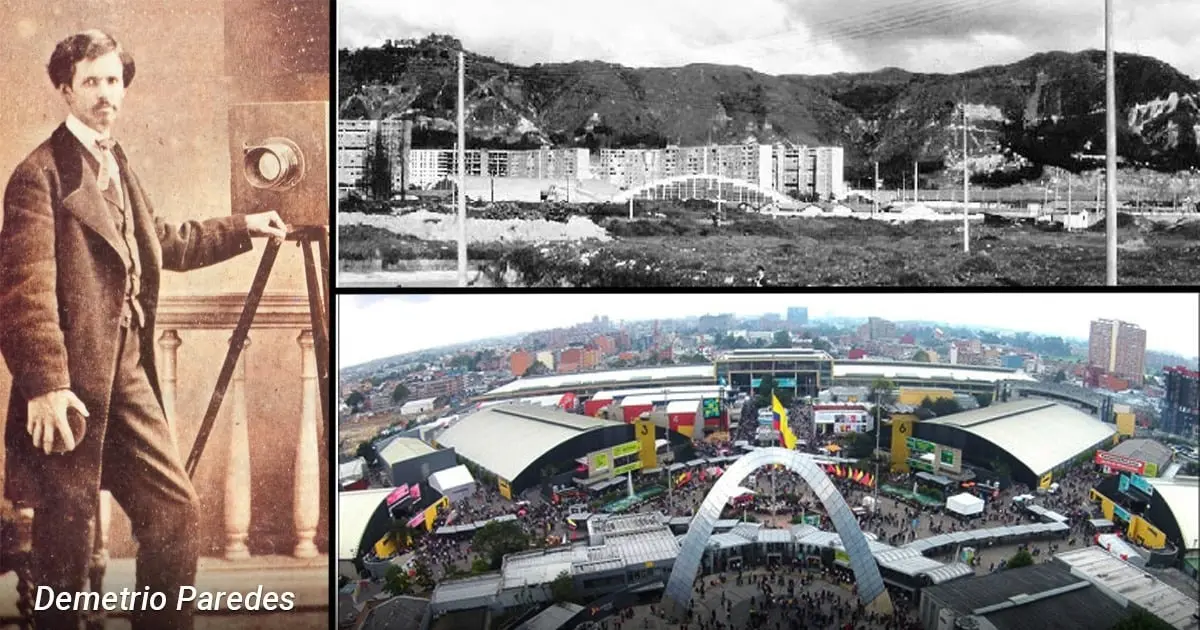
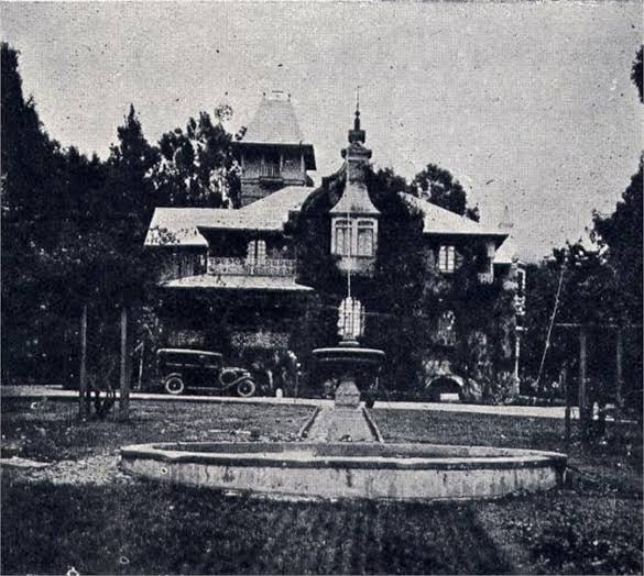
At the heart of this landscape sat the Quinta de Demetrio Paredes—a sprawling recreational and agricultural estate owned by Demetrio Paredes Serrano. Far more than a traditional landowner, Paredes was a towering figure in 19th-century Colombian enterprise: a visionary photographer trained in the United States, a pioneering lithographer who imported cutting-edge German machinery, and a key political player during the Republic’s formative decades.

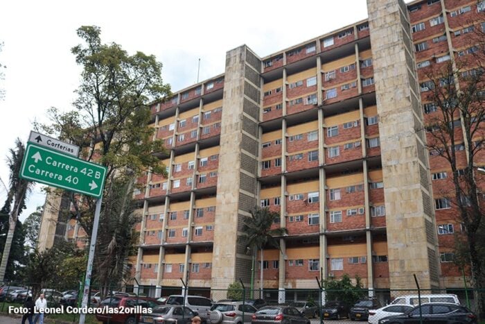
The estate he cultivated as a rural sanctuary eventually yielded to the relentless march of urbanization. By 1936, as Bogotá burst past its colonial borders to transform into a modern metropolis, the vast pastures of the Quinta were officially parcelled out for residential development. This gave birth to the iconic neighborhood of Quinta Paredes—a historic residential enclave nestled within the modern locality of Teusaquillo. Today, while the neighborhood coexists with major infrastructural hubs like Corferias and the surrounding university districts, its name stands as a permanent archival marker, preserving the memory of a Bogotá that was eventually swallowed by the city it became.
Chronology
To understand the transformation of Quinta Paredes, one must trace the evolution of Bogotá across nearly a century of profound political, social, and structural upheaval.

- 1851–1855: Following years of travel and specialized photography studies in the United States, Demetrio Paredes returns to his native Bogotá. He establishes roots in the capital and opens several pioneering photographic studios, quickly gaining renown among the city’s elite.
- 1860: Colombia enters a turbulent period of civil conflict known as the War of the Sovereignties, pitting the conservative forces of Mariano Ospina Rodríguez against the radical liberal rebels led by Tomás Cipriano de Mosquera. Concurrently, Bogotá begins its tentative outward expansion, relocating its central marketplace from the Plaza Mayor (now Plaza de Bolívar) to San Victorino and initiating early residential developments in Chapinero.
- 1863: Demetrio Paredes founds Litografía Paredes on the old Carrera Tundama (current-day Calle 13) in Bogotá’s historic center. By importing state-of-the-art German printing technology and employing foreign specialists, the workshop captures a near-monopoly on the production of secure state documents, banknotes, and credit bonds for both the national government and early private banks.
- Late 19th Century: Paredes acquires vast tracts of fertile land west of the colonial center, establishing the Quinta Paredes. Simultaneously, due to the immense economic and strategic value of his printing operations, the national government acquires the lithography infrastructure, laying the foundational stone for what would eventually become the National Printing Office of Colombia (Imprenta Nacional de Colombia).
- Early 20th Century: The western territories, colloquially referred to at times as Finca El Recuerdo, serve as an exclusive countryside retreat and dairy farming hub for Bogotá’s aristocracy, bounded by rich natural water sources like the Fucha and Arzobispo rivers.
- 1936: The historic rural era of the estate officially concludes. The prominent real estate firm Constructora Ospina y Compañía acquires the lands of the Quinta de Demetrio Paredes, parceling the sprawling pastures to construct urban housing. This decisive municipal act officially births the neighborhood of Quinta Paredes, cementing its place in the early development of the Teusaquillo locality.
Supporting Data
The metamorphosis of Quinta Paredes reflects broader demographic, economic, and geographical shifts in Colombia’s capital during the transition from a traditional colonial village to a sprawling republic hub:
- Demographic Scale: During the 1860s, Santafé de Bogotá housed a mere 43,000 residents. The populace lived in tight-knit, highly religious communities where nearly everyone was acquainted, contrasting sharply with the multi-million metropolis of modern times.
- Geographic Boundaries: The historical city was strictly confined by natural and artificial limits. The southern boundary was marked by the San Agustin River (modern-day Calle Sexta), while the northern boundary ran along the San Francisco River (modern-day Avenida Jiménez), anchoring the core around La Candelaria and Plaza de las Nieves.
- Estate Dimensions: The original Quinta Paredes was a massive expanse of rural wealth. Its historical borders spanned north toward the grounds of the current National University and Avenida El Dorado; south toward the old Railway Avenue (now Calle 22); east along Carrera 40 (bordering the El Recuerdo neighborhood); and west toward Carrera 50 and the grounds that now house Corferias.
- Agricultural Output: Benefiting from the nutrient-rich soils nourished by the Fucha and Arzobispo rivers, the estate specialized in high-altitude cold-climate crops. These included vast pastures for dairy cattle and horse grazing, alongside staple crops such as potatoes, corn, barley, peas, assorted green vegetables, and aromatic herbs.
- Architectural and Material Culture: 19th-century bogotanos navigated unpaved, narrow stone-cobbled streets clad in heavy woolen ruanas, dark coats, thick hats, and heavy shawls to combat the persistent high-altitude chill. Homes were predominantly constructed of adobe and rammed earth (tapia pisada) with heavy red-clay tile roofs, illuminated at night by rudimentary tallow and gas lanterns.
Official Responses
While historical archives and municipal chroniclers primarily record the evolution of Quinta Paredes through real-name transactions and structural realignments, urban planners, cultural preservationists, and municipal authorities continually address the balancing act between modernization and the preservation of historical memory:
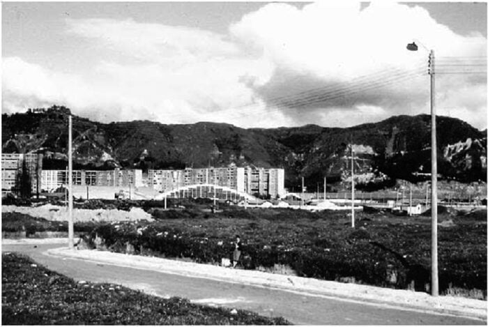
- Recognition of Urban Heritage: The District Institute of Cultural Heritage (IDPC) and local historians frequently highlight Teusaquillo—and by extension Quinta Paredes—as a masterclass in early 20th-century suburban planning in Bogotá. Authorities emphasize that the preservation of neighborhood nomenclature, such as retaining the Paredes family name, serves as a crucial bridge connecting contemporary citizens to the capital’s agrarian roots.
- Modern Redevelopment Balance: As zones like Quinta Paredes, El Recuerdo, and the Corferias exhibition complex undergo continuous commercial and infrastructural densification, city planning offices emphasize regulations designed to protect the architectural integrity of surviving early residential structures. Urban planning frameworks stress the necessity of accommodating high-impact business tourism and institutional growth while respecting the historical residential scale established by the Ospina construction projects of the 1930s.
Implications
The transition of Quinta Paredes from a private rural estate into a vibrant urban cornerstone carries profound implications for how Bogotá understands its own growth, modernization, and cultural identity:
- Erase-and-Build Realities: The story of Demetrio Paredes’ land is a microcosm of Bogotá’s broader spatial evolution. As the city expanded outward to absorb surrounding haciendas like El Salitre and La Magdalena de Teusaquillo, it systematically replaced agrarian ecosystems with concrete, asphalt, and grid-iron neighborhoods. This historical trajectory underscores the perpetual tension between urban expansion and environmental conservation in the Andean savanna.
- Evolution of Commerce and Industry: Paredes’ dual legacy—as both an agricultural pioneer and a titan of early industrial printing—illustrates the multifaceted nature of 19th-century Colombian elites. The evolution of his private lithography workshop into the National Printing Office demonstrates how early private enterprise laid the institutional and technical groundwork for state infrastructure.
- Identity of Modern Teusaquillo: Today, Quinta Paredes stands as a physical layered text. Visitors traversing the streets near Corferias walk atop grounds that once echoed with the hooves of dairy cattle and the rustle of barley fields. By maintaining its historic identity amidst the rush of modern conventions, trade shows, and urban transit, Quinta Paredes serves as a lasting reminder that Bogotá’s modern metropolitan identity was forged entirely out of a cold, isolated, and intensely agrarian highland village.




Leave a Reply