

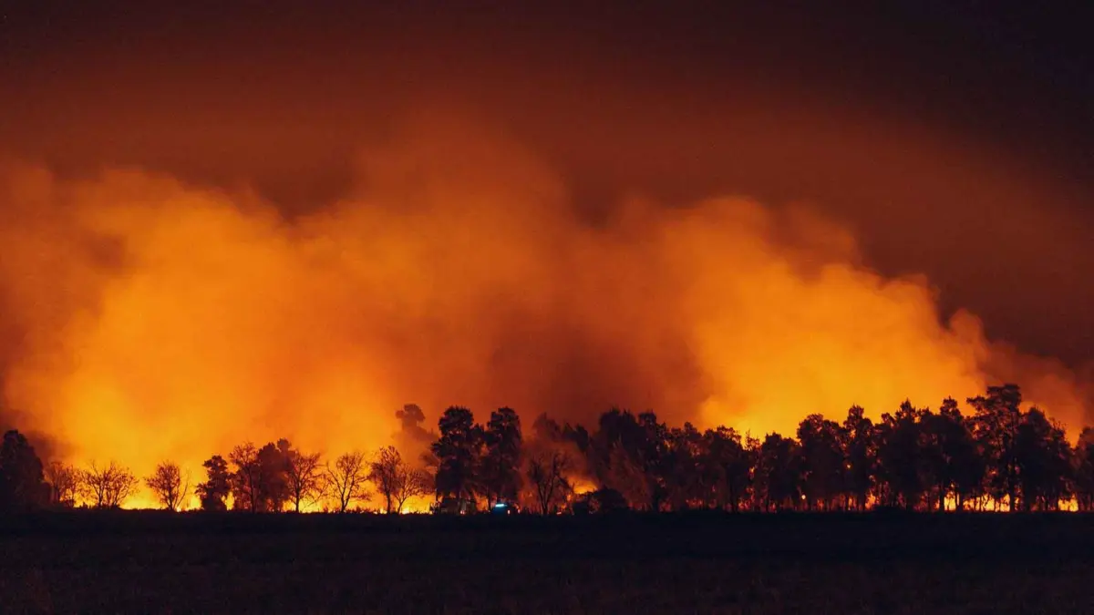
As wildfire seasons grow increasingly severe and unpredictable, thick blankets of smoke can drift hundreds or even thousands of miles away from active blazes, enveloping communities that are nowhere near the flames. Residents often step outside to find a hazy, sepia-toned sky or catch the unmistakable scent of burning timber in the air. However, sensory perceptions alone—such as the smell of smoke or the murkiness of the horizon—cannot accurately determine the toxicity of the air you are breathing.
To bridge this information gap, environmental agencies rely on standardized metrics to quantify atmospheric pollution. Checking specialized monitoring tools like AirNow’s Fire and Smoke Map before heading outdoors can fundamentally alter your daily routine, helping you decide whether it is safe to exercise outside now or if you should wait for conditions to improve.
Main Facts: Understanding the Air Quality Index (AQI)
The Air Quality Index (AQI) is the primary metric established by environmental protection authorities to inform the public about daily outdoor air conditions. Designed to be accessible, the index translates complex chemical concentrations into a unified, color-coded scale ranging from 0 to 500.
Rather than requiring citizens to calculate precise concentrations of individual pollutants, the AQI categorizes air quality into six distinct color tiers:
- Green (0–50): Good
- Yellow (51–100): Moderate
- Orange (101–150): Unhealthy for Sensitive Groups
- Red (151–200): Unhealthy
- Purple (201–300): Very Unhealthy
- Maroon (301+): Hazardous
The benchmark value of 100 serves as a critical threshold. Up to a value of 100, air quality is generally considered satisfactory. However, readings between 51 and 100 may present mild risks for unusually sensitive individuals. Once the AQI surpasses 100 and enters the orange category, the air is officially classified as unhealthy for sensitive groups, including children, the elderly, and those with pre-existing respiratory or cardiovascular conditions.
During active wildfire events, AQI readings carry a short expiration date. Environmental agencies warn that smoke plumes are highly dynamic; wind shifts, changes in fire behavior, and atmospheric inversions can cause pollution levels to fluctuate rapidly over the course of a few hours. A morning reading of "Good" air quality does not guarantee that conditions will remain safe by the afternoon.
Chronology: The Dynamic Evolution of Wildfire Smoke
Understanding how smoke behaves temporally is essential for minimizing health risks during an active wildfire crisis. Because atmospheric conditions are in constant flux, a standard daily forecast is often insufficient.
Morning Assessments vs. Afternoon Reality
- Early Morning (6:00 AM – 9:00 AM): Cool, stable morning air often traps pollutants near the ground, causing localized AQI spikes. Many residents wake up to heavy smoke settling in valleys and neighborhoods.
- Midday (11:00 AM – 3:00 PM): As solar radiation heats the earth, thermal mixing can sometimes disperse surface-level pollutants, temporarily improving local readings. Conversely, shifting wind patterns can push fresh smoke columns directly into a region that was clear earlier in the day.
- Evening and Night (6:00 PM onward): As temperatures drop, atmospheric layers often stabilize again, trapping smoke close to the surface for the evening commute or nighttime outdoor activities.
Because of these shifts, relying on a single morning check is risky. Checking real-time updates multiple times a day provides a more accurate picture of local air conditions.
Supporting Data: The Science of PM2.5 and Atmospheric Monitoring
When communities are blanketed in wildfire smoke, one specific technical term dominates meteorological reports: PM2.5.
What is PM2.5?
PM2.5 refers to atmospheric particulate matter with a diameter of 2.5 micrometers or smaller—roughly 30 times smaller than the width of a human hair. These microscopic particles are a primary constituent of wildfire smoke, composed of a complex mixture of microscopic solids, liquid droplets, organic chemicals, and heavy metals derived from burned biomass.
Why PM2.5 Poses a Severe Health Threat
Due to their minuscule size, PM2.5 particles bypass the body’s natural filtration defenses in the nose and upper respiratory tract. When inhaled, they penetrate deep into the pulmonary alveoli—the tiny air sacs in the lungs—and can even cross the alveolar-capillary membrane directly into the bloodstream.
Short-term exposure can cause:
- Immediate eye, nose, and throat irritation
- Persistent coughing and wheezing
- Shortness of breath and chest tightness
Longer-term or high-concentration exposures are linked to the exacerbation of chronic conditions, including asthma, chronic obstructive pulmonary disease (COPD), and cardiovascular diseases such as heart attacks and strokes.
Decoding the Map: Monitors, Sensors, and Plumes
When navigating the AirNow Fire and Smoke Map by ZIP code, users encounter various symbols representing different data-gathering technologies:
- Large Circles with Numbers: Permanent regulatory monitors maintained by government agencies, offering the highest level of data accuracy.
- Medium Circles with a "T": Temporary regulatory monitors deployed specifically to track emergency events like active wildfires.
- Small Circles without Letters or Numbers: Low-cost particulate sensors (such as PurpleAir monitors) deployed by private citizens or institutions, which help fill geographical gaps in coverage.
- Smoke Plumes: Satellite-derived polygonal overlays showing the geographic extent of smoke high up in the atmosphere. Official advisories emphasize that seeing a smoke plume overhead does not automatically mean surface-level air is toxic; users must verify ground conditions using local sensor readings.
Official Responses and Public Health Recommendations
Public health agencies and environmental authorities have established clear, actionable guidelines for mitigating the health impacts of wildfire smoke exposure.
Recognizing High-Risk Scenarios
When the AQI climbs into the orange zone (101–150) and beyond, official guidance advises vulnerable populations—including pregnant women, children, older adults, and individuals with heart or lung diseases—to remain indoors and avoid prolonged or heavy exertion.
Modifying Physical Activity
Strenuous outdoor activities significantly increase the volume of air inhaled, drawing greater quantities of toxic PM2.5 deep into the lungs. Official recommendations include:
- Postponing Exercise: Delaying runs, bicycle rides, or lawn mowing until air quality returns to the green or yellow zones.
- Reducing Intensity: Opting for lighter indoor workouts rather than high-intensity outdoor training when smoke is present.
- Restricting Outdoor Time: If outdoor labor or commuting is unavoidable, limit exposure to essential tasks and take frequent breaks in indoor spaces equipped with high-efficiency particulate air (HEPA) filtration systems.
Implications: Adapting to a Smokier Future
As global climate change increases the frequency, intensity, and duration of catastrophic wildfires, managing air quality has transitioned from an occasional inconvenience to a permanent public health priority.
Communities, urban planners, and individuals must adapt to this new normal. Public infrastructure is increasingly focusing on the creation of "clean air shelters"—public buildings equipped with commercial-grade air filtration systems where vulnerable populations can seek refuge during extreme smoke events. At the individual level, checking the AQI has become as routine as checking the daily weather forecast or UV index.
By understanding how to interpret meteorological tools like the AirNow Fire and Smoke Map, recognizing the dangers of PM2.5 particulate pollution, and responding proactively to shifting environmental data, individuals can safeguard their respiratory health and navigate wildfire seasons with confidence and preparedness.


Leave a Reply