

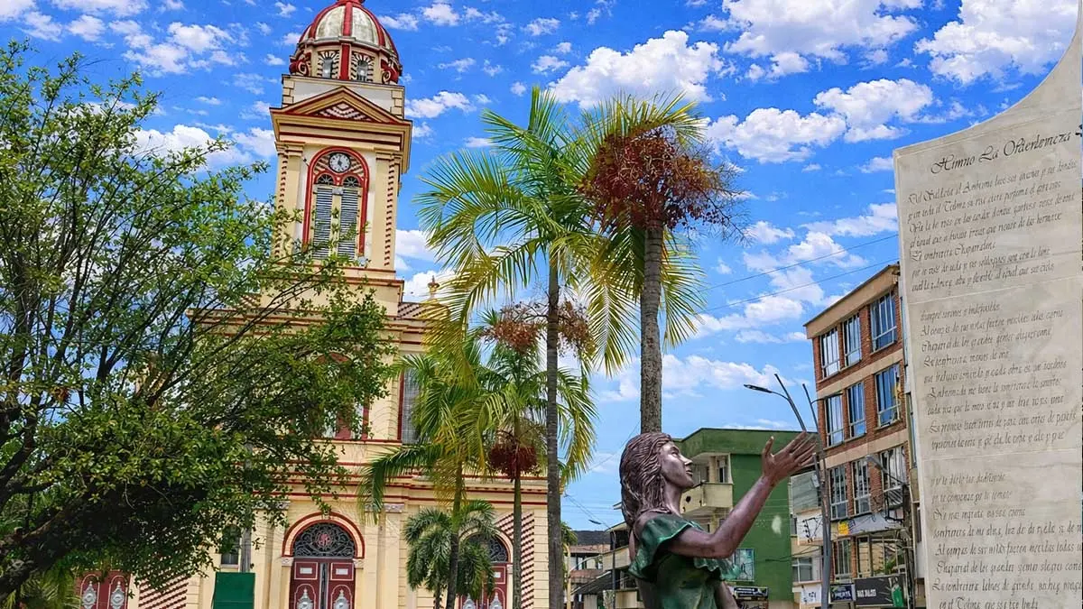
BOGOTÁ, Colombia — The Andean slopes of central Colombia have become the epicenter of an unusual and intense geological phenomenon. The Colombian Geological Survey (Servicio Geológico Colombiano – SGC) reported a continuous seismic swarm centered in the municipality of Chaparral, in the department of Tolima. Beginning in the early hours of Sunday, September 20, the region has been rocked by more than 130 tremors with magnitudes exceeding 2.0, prompting widespread concern among residents across multiple departments and triggering intensive round-the-clock monitoring by national disaster response agencies.
The ongoing geological event has not only rattled homes and nerves locally but has also reverberated across a broad swath of the Colombian territory, with citizen reports pouring in from at least five neighboring departments. While seismologists emphasize that such swarms are characteristic of countries situated along active tectonic belts, the sheer frequency and concentration of the tremors over a compressed 36-hour window have placed local authorities and the scientific community on high alert.
Main Facts
The seismic sequence in Chaparral represents a significant deviation from normal baseline seismicity in the region. According to official data consolidated by the SGC’s National Seismological Network, the swarm kicked off in the pre-dawn hours of Sunday, September 20. By 3:30 p.m. on Monday, September 21, scientific instruments had logged a staggering cumulative total of more than 130 individual earthquakes with magnitudes scaling above 2.0.
Key Metrics of the Seismic Event:
- Total Tremors Recorded (>2.0 Magnitude): Over 130 events within 36 hours.
- Significant Shocks (≥4.0 Magnitude): Five distinct earthquakes have surpassed this threshold, releasing considerably more energy and generating widespread alarm.
- Depth: All recorded events have been shallow, registering at depths of less than 30 kilometers. Shallow earthquakes of this nature are frequently felt much more intensely by populations living directly above or near the epicenter, as the seismic waves lose less energy traveling through the Earth’s crust before reaching the surface.
- Geographic Reach: Though centered in the rural and urban sectors of Chaparral, Tolima, the tremors have been widely felt outside the department. The SGC has compiled over 1,000 citizen perception reports from departments as far-flung as Huila, Valle del Cauca, Quindío, Risaralda, and Cauca.
Freddy Tovar, coordinator of the National Seismological Network at the SGC, noted that the density of seismic events recorded over this two-day span is exceptionally high, standing well above the average baseline activity observed in the region over preceding weeks and months.
Despite the high count of tremors, initial rapid-response assessments by local disaster committees and municipal authorities in Chaparral have not reported catastrophic structural collapses, mass infrastructure failures, or widespread casualties. However, emergency response teams remain deployed and vigilant as the earth continues to rumble intermittently.
Chronology of the Event
Understanding the evolution of a seismic swarm requires a detailed temporal breakdown. The sequence in Chaparral did not manifest as a single, devastating major earthquake followed by declining aftershocks (the typical mainshock-aftershock sequence); rather, it behaves as a cluster of numerous moderate-to-small earthquakes occurring in close spatial and temporal proximity.
Phase 1: Onset and Early Morning Tremors (Sunday, September 20)
The activity commenced quietly in the dark hours of Sunday morning. The initial low-magnitude precursors were largely imperceptible to the general public, registered only by the sensitive broadband seismographs of the National Seismological Network. However, as the morning progressed, magnitudes began to tick upward. By mid-day Sunday, several tremors crossed the 3.0 threshold, prompting residents in rural hamlets and the main urban center of Chaparral to run out into the streets.
Phase 2: Intensification and Moderate Shocks (Sunday Night to Monday Morning)
As Sunday night fell, the frequency of the tremors did not abate; instead, it intensified. The SGC tracking systems noted a clustering of events occurring every few minutes to every hour. During this overnight phase, the first major benchmark shocks of magnitude 4.0 or higher struck the region. These sharper jolts were accompanied by deep, subterranean rumbling sounds that heightened anxiety among local communities, many of whom spent the night outdoors or in open public squares out of fear of structural collapses.
Phase 3: Peak Swarm Density and Broad Perception (Monday, September 21)
By Monday morning, the cumulative count had rapidly scaled past the century mark. At 3:30 p.m. on Monday, the SGC released updated metrics confirming that more than 130 earthquakes above magnitude 2.0 had shaken the area. This phase was characterized by a massive influx of citizen reports. Because the tremors were occurring at shallow depths (<30 km), individuals sitting in offices, schools, and homes hundreds of kilometers away in cities across the Andean and coffee-growing regions reported feeling sudden, rolling, or abrupt shaking.
Supporting Data and Technical Context
To comprehend why the ground in Chaparral has not stopped moving, it is necessary to examine Colombia’s complex geological makeup. Colombia is globally recognized as one of the most seismically active regions on Earth due to its geographic position atop the Northern Andean Block, where three major tectonic plates converge: the Nazca Plate, the South American Plate, and the Caribbean Plate.
The Role of Local Fault Systems
Tolima is historically and geographically cross-hatched by an intricate network of active geological faults. The SGC has explicitly pointed to the presence of these active fault systems in the Chaparral region as the primary driver behind the current seismic swarm.
Unlike subduction-zone earthquakes—which occur offshore or deep beneath the continent where plates collide and can generate massive mega-thrust events—crustal fault swarms involve the reactivation or readjustment of localized fault lines within the Earth’s upper crust. When stress accumulates along these regional fractures due to tectonic compression from the westward-moving South American plate resisting the subducting Nazca plate, the rocks eventually yield. Instead of a single catastrophic fracture releasing all the built-up energy at once, the stress is sometimes relieved through a continuous series of smaller, cascading slips. This mechanical process creates what geologists define as a seismic swarm.
Statistical Deviation from the Baseline
Seismological monitoring relies heavily on baseline comparisons. In a normal week, the SGC’s monitoring screens register background micro-seismicity across Tolima that goes virtually unnoticed by the populace. However, the accumulation of over 130 validated events above magnitude 2.0—featuring five distinct events hitting or exceeding magnitude 4.0 within a 36-hour window—represents a statistically anomalous spike.
Furthermore, the geographic dispersion of the felt reports—spanning Huila, Valle del Cauca, Quindío, Risaralda, and Cauca—highlights how efficient shallow crustal faults can be at propagating seismic energy across complex Andean topography. Mountainous terrain can sometimes trap or channel seismic waves, amplifying ground motion in specific valleys while dampening it in others.
Official Responses
In the wake of the continuous shaking, national and local institutions have mobilized to manage public safety, disseminate accurate information, and calm a rattled populace.
The Colombian Geological Survey (SGC)
The SGC has assumed a central role in communicating scientific realities to the public. Operating through its National Seismological Network, the agency has maintained a continuous, 24/7 watch over the Chaparral epicentral zone.
Senior officials, including National Seismological Network Coordinator Freddy Tovar, have stressed transparency, frequently updating data feeds and releasing public explanations regarding the tectonic origins of the swarm. The SGC has taken proactive steps to manage public anxiety, explicitly urging citizens to ignore and avoid sharing unverified rumors, panic-inducing voice notes, or out-of-context videos circulating on social media networks. The agency reminded the public that science cannot yet predict the exact day, time, or magnitude of an impending earthquake, making preparedness far more critical than speculation.
Disaster Risk Management and Local Authorities
At the national level, the National Unit for Disaster Risk Management (Unidad Nacional para la Gestión del Riesgo de Desastres – UNGRD) has coordinated closely with regional departmental committees in Tolima and municipal emergency coordinators in Chaparral.
Local civil defense units, firefighters, and police departments were placed on preventive alert status over the weekend. Rapid assessment teams were dispatched to inspect critical infrastructure, including public schools, hospitals, bridges, rural water systems, and historical buildings in Chaparral. While initial inspections revealed no structural failures that would compromise public safety, local authorities have advised residents in older adobe or unreinforced masonry structures to remain vigilant and identify safe zones within their homes.
Communities have also been instructed to follow official communication channels provided by the Mayor’s Office of Chaparral, the Tolima Governor’s Office, and the UNGRD for ongoing safety guidelines and updates.
Implications and Future Outlook
As the earth beneath Tolima continues to adjust, the ongoing seismic swarm carries several critical implications for local populations, regional emergency planning, and scientific observation.
1. Psychological Impact and Community Preparedness
Continuous, low-level shaking takes a heavy psychological toll on communities. Unlike a single major earthquake where the primary trauma is followed by a period of reconstruction, a prolonged seismic swarm keeps populations in a state of hyper-vigilance. Every minor rumble or vibration triggers anxiety over whether a larger, destructive shock is about to follow. Local health authorities in Tolima have begun evaluating the need to provide psychological first aid and mental health support lines for residents in Chaparral who are experiencing acute stress and insomnia due to the ongoing tremors.
2. Infrastructure Vulnerability in Rural Areas
While urban centers in Tolima generally adhere to modern seismic resistant building codes (NSR-10), rural and remote municipalities like Chaparral often feature a mix of traditional and older vernacular architecture. Adobe, bahareque, and unreinforced brick structures are particularly vulnerable to prolonged, repetitive ground shaking, which can progressively weaken mortar and load-bearing walls even if individual tremors do not exceed moderate magnitudes. The swarm serves as an urgent stress test for local rural housing durability and reinforces the necessity for ongoing structural vulnerability reduction programs.
3. Scientific Monitoring and Research Value
For the scientific community at the SGC, this seismic swarm presents a valuable, high-resolution dataset. Capturing real-time data from over 130 crustal earthquakes clustered tightly in time and space allows seismologists to map local fault geometries with unprecedented clarity. By analyzing focal mechanisms and wave propagation patterns, researchers can gain deeper insights into the crustal stress distribution beneath the Central Cordillera of the Colombian Andes, ultimately refining long-term seismic hazard models for the entire region.
What Lies Ahead?
As of late Monday afternoon, the SGC confirmed that monitoring will remain active on a permanent basis. Geologists note that seismic swarms can behave unpredictably: they may gradually taper off over the coming days as the local fault system achieves a new state of mechanical equilibrium, or they could occasionally precede a slightly larger tectonic adjustment.
For now, authorities emphasize resilience, preparedness, and reliance on verified scientific information. Citizens across Tolima and neighboring departments have been encouraged to keep emergency go-bags ready, review family evacuation plans, and stay tuned to institutional channels as the region navigates this active geological chapter.




Leave a Reply