

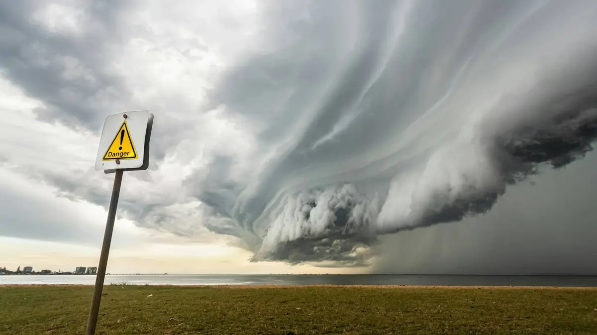
FLORIDA — Emergency management agencies, local governments, and millions of residents across the southeastern United States are bracing for the imminent impact of Hurricane Isaías. Rapidly intensifying over warm Gulf waters after tracking near Mexico, the storm is projected to make landfall on Friday, October 9, 2026. Evolving quickly from a tropical disturbance into a formidable hurricane, Isaías marks the first major hurricane of an otherwise unusually quiet 2026 season.
Governor Ron DeSantis has already declared a state of emergency across 25 counties, primarily targeting the Panhandle and Big Bend regions. Meteorologists warn that the system could escalate into a Category 3 hurricane before hitting the coast, bringing catastrophic hazards, including torrential rainfall exceeding 10 inches, destructive winds, and severe coastal and inland flooding.
Main Facts
Hurricane Isaías represents a serious and immediate threat to life and property across the Gulf Coast, with severe weather impacts stretching from Alabama through northwest Florida and into southwest Georgia.
- Landfall Projections: The storm is scheduled to hit the U.S. Gulf Coast late Friday, October 9, 2026. Experts at the National Weather Service (NWS) note that the system is continuing to feed on warm waters, raising concerns that it could achieve Category 3 status just hours before impact.
- Geographic Scope: The state of emergency covers 25 Florida counties. Cities facing the highest immediate risk include Pensacola, Destin, Panama City, Tallahassee, Apalachicola, Port St. Joe, and Fort Walton Beach. However, authorities stress that complacency is dangerous, and the entire region must remain vigilant.
- Primary Hazards: The storm’s defining danger is excessive rainfall. Forecasters predict localized flooding exceeding 10 inches in several areas, accompanied by hurricane-force winds capable of uprooting mature trees, snapping power lines, and generating dangerous storm surges.
- Infrastructure and Mobility Restrictions: While public transportation, commercial flights, and major highways remain operational for ongoing evacuation and preparation efforts, severe disruptions are anticipated starting Friday evening. Authorities are prepared to restrict road access dynamically as conditions deteriorate.
Chronology of the Storm: From Disturbance to Major Threat
The trajectory of Hurricane Isaías highlights the unpredictable nature of modern meteorological phenomena, breaking a prolonged period of atmospheric calm in the Pacific and Gulf basins.
Early Formation and Tracking
Initially monitored as a disorganized cluster of thunderstorms near the Mexican coastline, the system exhibited signs of rapid organization earlier in the week. Favorable atmospheric conditions and high sea-surface temperatures provided the fuel necessary for rapid intensification.
Mid-Week Escalation
By Wednesday, meteorological models confirmed that the system had transitioned into a tropical storm, prompting early advisories from the National Hurricane Center. As it tracked northeastward toward the U.S. Gulf Coast, its wind fields expanded, and barometric pressure dropped significantly. Recognizing the accelerated threat profile, the system was officially upgraded to a hurricane.
The Countdown to Landfall (Friday, October 9)
As of Thursday, outer rainbands began impacting the coastal fringes of the Florida Panhandle. Evacuation warnings, school closures, and remote-work mandates went into effect across multiple municipalities. The critical window for outdoor preparations is rapidly closing, with conditions expected to deteriorate sharply by Friday afternoon. The peak impact—characterized by intense winds, torrential downpours, and severe flooding—is locked in for Friday night through Saturday morning.
Supporting Data and Meteorological Analysis
Understanding the scale of Hurricane Isaías requires looking closely at the environmental data driving its intensity and the specific vulnerabilities of the affected regions.
Rainfall and Storm Surge Projections
Meteorological models indicate that slow-moving storm segments could drop historic amounts of rain. Accumulations surpassing 10 inches in localized zones will saturate soil that is already damp from seasonal precipitation, drastically increasing the risk of flash floods and overflowing river basins. Coastal areas must also prepare for significant storm surges that could inundate low-lying beach communities and coastal highways.
The Electric Vehicle (EV) Hazard
A unique and pressing data point highlighted in this year’s emergency guidelines involves electric vehicles (EVs). Saltwater and deep floodwaters pose a severe risk to lithium-ion battery packs, potentially triggering delayed-action thermal runaway and spontaneous fires. Emergency services have issued explicit warnings for EV owners in flood-prone zones to relocate their vehicles to higher ground well ahead of Friday night.
Economic and Logistical Disruptions
Private sector continuity plans have swung into action. Numerous school districts throughout the Panhandle have suspended classes through the end of the week, and corporate offices have mandated remote work to keep non-essential personnel off the roadways. Supply chains are adjusting delivery schedules, though essential freight corridors remain open under close monitoring by the Florida Department of Transportation.
Official Responses and Emergency Preparedness
State and local authorities have adopted a proactive posture, balancing urgent warnings with reassurances to prevent widespread panic.
Government Actions and Declarations
The emergency declaration by Governor DeSantis unlocks vital state resources, streamlining the deployment of the Florida National Guard, search-and-rescue teams, and medical units to strategic staging areas across the Panhandle and Big Bend. Local emergency operations centers (EOCs) have activated at Level 1, coordinating round-the-clock monitoring and response strategies.
Public Safety Directives
Emergency management officials have issued clear, non-negotiable guidelines for residents in the path of the storm:
- Stay Off the Roads: Driving is strongly discouraged from Friday evening onward. Flash floods can obscure washed-out bridges and hidden road craters. Furthermore, moving water only six inches deep can sweep a standard passenger vehicle off the road.
- Utilize Community Shelters: For residents living in mobile homes, low-lying areas, or structurally vulnerable buildings, local governments have opened designated community shelters stocked with emergency supplies, backup power, and medical personnel.
- Debris and Utility Pre-positioning: Linemen and debris-clearance crews are staged regionally, ready to mobilize the moment wind speeds drop to safe operating levels following landfall. Power outages are anticipated, and utility companies urge residents to prepare for multi-day blackouts.
Implications for Mobility, Infrastructure, and Future Resilience
The arrival of Hurricane Isaías underscores broader vulnerabilities in regional infrastructure and highlights how climate dynamics are shifting emergency management paradigms.
The Critical Role of Transportation Networks
In any severe weather event, mobility is synonymous with survival. The ability to evacuate populations, route emergency vehicles, and deliver relief supplies depends entirely on the resilience of highways and bridges. Florida’s transportation sector faces a rigorous test. While dynamic lane management and pre-positioned heavy tow trucks help mitigate bottlenecks, the sheer volume of water expected from Isaías threatens to overwhelm drainage systems along key interstate corridors.
Aviation and Public Transit Outlook
Commercial aviation across regional hubs—including Pensacola International Airport and Tallahassee International Airport—is bracing for widespread cancellations and ground stops. Public transit networks will operate on reduced schedules on Friday before implementing complete suspensions if sustained winds exceed safety thresholds. Travelers are advised to check airline statuses directly before heading to terminals.
Lessons for the 2026 Season and Beyond
Coming after an unusually quiet period in tropical activity, Hurricane Isaías serves as a stark reminder that it only takes one major system to define a hurricane season. Urban planners and civil engineers are closely analyzing the storm’s interaction with coastal defenses and stormwater management systems. The insights gained from Isaías will directly influence future infrastructure investments, zoning laws in flood-prone coastal zones, and public communication strategies for extreme weather events.
Conclusion
As Hurricane Isaías bears down on the Gulf Coast, the coming hours will test the preparedness, resilience, and solidarity of communities across Florida, Alabama, and Georgia. Residents are urged to remain tuned to official channels, finalize their safety preparations immediately, and prioritize human life above all else as the region confronts its first major meteorological test of 2026.


Leave a Reply