

For over a century, human intuition dictated that to understand the hidden depths of our planet, we had to rely on earthquakes. Seismology has long served as humanity’s primary flashlight, tracing the trajectory of seismic waves as they rebound and refract through layers of varying density to reconstruct an anatomical map of the Earth’s interior. Yet, while seismic waves excel at mapping structures, they are blind to energy. They can reveal where rock boundaries lie, but they cannot tell us how much heat is produced deep below our feet, nor can they accurately audit the radiogenic engine driving our dynamic world.
Today, science is transitioning from merely "seeing" the Earth’s interior through seismic imaging to "accounting" for its internal heat using ghost-like, nearly invisible particles known as geoneutrinos. By tracking these subatomic travelers, researchers are pioneering a conceptual leap: moving toward a statistical "heat tomography" that measures the planet’s internal energy budget in real time.
Main Facts
The study of geoneutrinos represents a profound convergence of particle physics and geophysics.
- What are Geoneutrinos? Specifically classified as electron antineutrinos, these particles are produced during the radioactive decay chains of uranium-238 and thorium-232 dispersed throughout the Earth’s crust and mantle. Potassium-40 also contributes to the planet’s radiogenic budget, though its antineutrinos largely fall below the energy threshold accessible by standard detection techniques.
- The Ghostly Nature of Particles: Geoneutrinos possess an astonishing capacity to pass through matter virtually unhindered. They emerge from thousands of kilometers deep within the Earth and travel to the surface completely unaccelerated or slowed, carrying raw data regarding deep-seated radioactive decays.
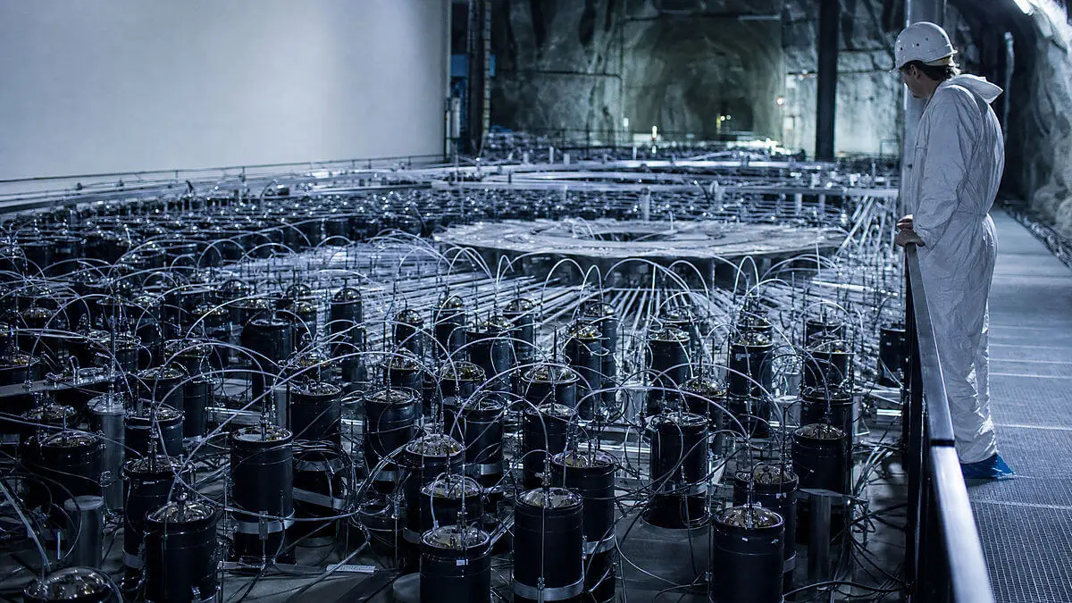
- The Detectors: Two premier underground laboratories have spearheaded this field: Borexino (located at the Gran Sasso National Laboratory in Italy) and KamLAND (situated in the Kamioka mine in Japan). Deeply embedded beneath solid rock, these facilities use massive vats of liquid scintillator shielded from cosmic rays to capture rare antineutrino interactions via inverse beta decay.
- The Core Challenge: The primary obstacle to measuring geoneutrinos is not subterranean, but anthropogenic. Nuclear reactors on the Earth’s surface emit electron antineutrinos with overlapping energy signatures, creating a massive "noise" floor that frequently dwarfs the planetary signal. For instance, in early Borexino analyses, out of 77 candidate events, roughly 53 were attributed to nuclear reactors, leaving only about 24 true geoneutrinos.
- The Mantle Contribution: By combining data from Borexino and KamLAND and subtracting the calculated crustal contribution using advanced 3D geological models, scientists have estimated the mantle’s radiogenic contribution to be approximately 14.1 ± 8.1 TNU (Terrestrial Neutrino Units) for uranium and thorium.
Chronology of Discovery and Milestones
The path toward utilizing particle physics as a geophysical tool spans several decades of theoretical proposals and painstaking experimental refinement:
- 1960s–1980s (Theoretical Foundations): Geochemists and physicists first seriously propose that antineutrinos produced by natural radioactive decay inside the Earth could theoretically be detected on the surface, offering a direct probe of the planet’s radiogenic heat sources.
- March 9, 2002: The KamLAND detector begins its long-term operations in Japan, setting the stage for precision neutrino oscillation studies and, eventually, geoneutrino detection.
- 2007–2019 (The Borexino Campaign): Borexino amasses 3,262.74 days of effective data collection, eventually publishing landmark combined analyses that constrain the combined uranium and thorium geoneutrino signal to 47.0 TNU.
- 2013 (The Joint Mantle Breakthrough): Researchers release joint Borexino-KamLAND analyses that successfully isolate the mantle’s contribution (~14 TNU) by subtracting the crustal signal through rigorous statistical modeling.
- December 31, 2020: KamLAND concludes its major extended data-collection run, spanning 5,227 days of operation and providing critical high-statistics constraints on uranium and thorium decay rates.
- 2026 (The Horizon of Directionality): Recent theoretical proposals and pre-publications explore the viability of deploying directional neutrino detectors on the ocean floor (such as in the Pacific Basin) to bypass continental crust interference and begin mapping mantle anomalies directly.
Supporting Data and Quantitative Metrics
To compare detectors of vastly different sizes and configurations without ambiguity, physicists employ the Terrestrial Neutrino Unit (TNU). One TNU corresponds to one detection event per $10^32$ free protons per year, assuming 100% detection efficiency.

Borexino Dataset Overview
- Operational Span: ~2007 to 2019 (3,262.74 days of active data).
- Total Exposure: $(1.29 pm 0.05) times 10^32$ proton·years.
- Combined Uranium & Thorium Geoneutrino Events: $52.6$ events (with $+9.4/-8.6$ statistical and $+2.7/-2.1$ systematic uncertainties).
- Total Signal Magnitude: $47.0 text TNU$ ($+8.4/-7.7$ statistical, $+2.4/-1.9$ systematic).
KamLAND Dataset Overview
- Operational Span: March 9, 2002, to December 31, 2020 (5,227 operational days).
- Uranium-Derived Events: $117$ ($+41/-39$).
- Thorium-Derived Events: $58$ ($+25/-24$).
- Total Fit Events (Free Ratio): $174$ ($+31/-29$).
- Total Fit Events (Fixed Chondritic Th/U Ratio of 3.9): $183$ ($+29/-28$).
These figures emphasize that the inner "accounting" of our planet is not a raw, uninterpreted tally. Instead, it is heavily dependent on composition assumptions, background reactor subtraction models, and statistical inference.
Official Responses and Scientific Consensus
The global geophysics and particle physics communities view geoneutrino science as one of the most exciting interdisciplinary frontiers of the 21st century.
Prominent researchers involved in both Borexino and KamLAND collaborations emphasize that while current measurements carry wide error margins, they mark an irreversible paradigm shift. Leading institutions note that the realization of a ~14 TNU mantle signal proves that deep-Earth radiogenic sources can indeed be decoupled from crustal noise through statistical rigor.
However, official scientific consensus strikes a tone of measured caution. Organizations and peer-reviewed groups explicitly warn against overstating the current capabilities of the technology:
- It is not a direct visual scan: Geoneutrinos do not provide a real-time computerized axial tomography (CAT) scan or thermal photograph of the mantle.
- It does not measure total planetary heat: Radiogenic heat (measured by geoneutrinos) is only one component of the Earth’s total heat budget. Primordial heat—leftover from planetary accretion and core formation—along with core crystallization processes, also drives the planetary thermal engine.
- Model Dependence: The accuracy of mantle heat extraction relies heavily on the accuracy of 3D crustal composition models. Any uncertainties regarding uranium and thorium concentrations in the shallow crust automatically propagate into calculations of deep mantle contributions.
Implications for Geosciences, Energy, and the Future
While geoneutrinos cannot predict earthquakes, forecast volcanic eruptions, or directly pinpoint commercial mineral and geothermal deposits, their broader implications for Earth sciences are profound.

Refining the Mantle’s Thermal Engine
Convection within the Earth’s mantle is the primary driver behind plate tectonics, continental drift, volcanism, and the creation of hydrothermal systems. By narrowing down the margin of error regarding radiogenic heat production, scientists can drastically improve rheological models—the mathematical descriptions of how solid rocks deform under immense pressure and temperature over geological timescales.
Geothermal Exploration and Hazard Assessment
More precise baseline thermal models allow geoscientists to evaluate long-term planetary evolution with greater fidelity. This foundational physics provides a sturdier bedrock for assessing large igneous provinces, understanding deep geothermal gradients, and mapping the large-scale dynamics of the Earth’s interior.
The Next Frontier: Ocean-Floor and Directional Detectors
The future of geoneutrino science lies in overcoming spatial and noise limitations. Two major strategies are set to define the next generation of research:
- Directional Detection: Developing advanced liquid scintillators or novel detection techniques capable of discerning the vector from which an antineutrino arrived, allowing scientists to separate homogeneous mantle sources from localized hotspots.
- Ocean-Floor Deployments: Placing massive detectors on the oceanic bed, far away from the thick continental crust rich in uranium and thorium, and significantly reducing interference from surface nuclear reactors. Recent sensitivity studies (such as evaluations for detectors in the Pacific Basin) suggest this approach could dramatically enhance our ability to resolve deep mantle structures like Large Low-Shear-Velocity Provinces (LLSVPs).
As quantum-level particle physics increasingly merges with applied geophysics, humanity is moving past mere speculation. We are beginning to genuinely audit the energy budget that keeps our world alive—transforming ghost particles from the deep cosmos and subsoil into the ultimate ledger of the living Earth.




Leave a Reply